Malargüe Department (Departamento de Malargüe)
The provincial subdivision has a population of about 23,000 inhabitants in an area of 41,317 km2, and its capital city is Malargüe, which is located around 1,180 km from the federal capital Buenos Aires.
The south of the Malargüe Department is considered as the north tip of the Patagonia and is home to the many nature reserves such as La Payunia, Castillos de Pincheira, Caverna de las Brujas and Laguna de Llancanelo.
Map - Malargüe Department (Departamento de Malargüe)
Map


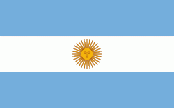
Country - Argentina
 |
 |
| Flag of Argentina | |
The earliest recorded human presence in modern-day Argentina dates back to the Paleolithic period. The Inca Empire expanded to the northwest of the country in Pre-Columbian times. The country has its roots in Spanish colonization of the region during the 16th century. Argentina rose as the successor state of the Viceroyalty of the Río de la Plata, a Spanish overseas viceroyalty founded in 1776. The declaration and fight for independence (1810–1818) was followed by an extended civil war that lasted until 1861, culminating in the country's reorganization as a federation. The country thereafter enjoyed relative peace and stability, with several waves of European immigration, mainly Italians and Spaniards, radically reshaping its cultural and demographic outlook; over 60% of the population has full or partial Italian ancestry, and Argentine culture has significant connections to Italian culture.
Currency / Language
| ISO | Currency | Symbol | Significant figures |
|---|---|---|---|
| ARS | Argentine peso | $ | 2 |
| ISO | Language |
|---|---|
| EN | English language |
| FR | French language |
| DE | German language |
| GN | Guarani language |
| IT | Italian language |
| ES | Spanish language |